
 Wow, what a day we had yesterday!!! About 10 AM we headed out to the Wilderness area near Dahlonega about 1.5 hours from our cabin.
There are a lot of hiking trails in that area that we haven't explored yet. The first two trails we explored were at DeSoto Falls where they have one trail to the Lower Falls then back, and another trail to the Upper Falls and back.
When we came to the trailhead we saw this sign. Bigify (by clicking the image) and you'll see that there is a warning to stay on the trails that folks have slipped on the rocks and fallen to their death - hmmm, good to know!

The trails was a super nice surface of red Georgia clay with occasion pea gravel mixed in areas. A few nice rock formations I enjoyed to cool off.

Cute little wooden bridge where I took a little break.

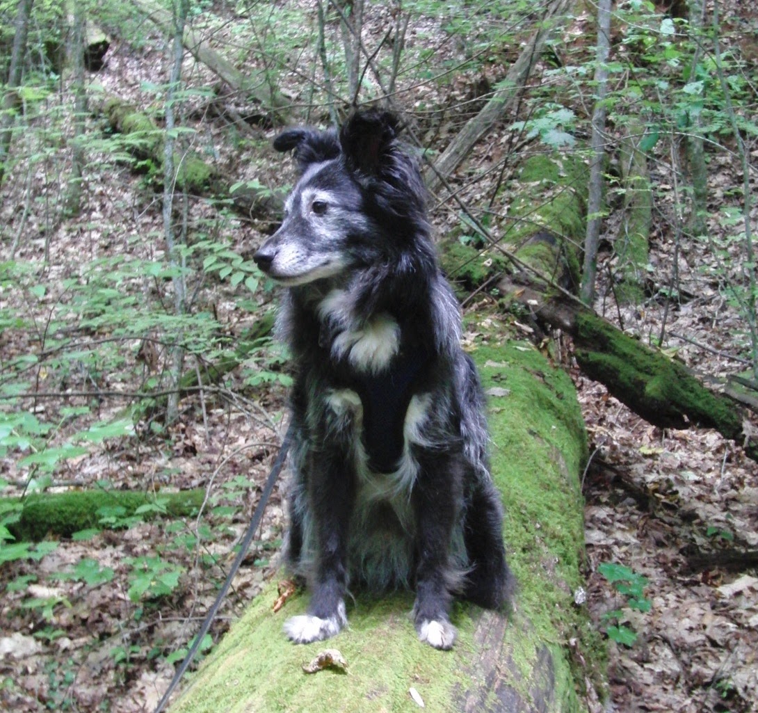
Mum loves that moss, so I indulged her with a photo of my butt on it, BOL!
Then we came to the Lower Falls, very pretty, serene and peaceful. We got them all to ourselves, and stopped to play in the fall pool.

Then we ventured back the way we came and headed up the trail to the Upper Falls. A very nice site!!!

We enjoyed a cool drink from the Falls and then took a little break before heading back to the car.

On the way back we stopped and talked with a couple who were camping and on their Honeymoon. Gracie and I gave them our congratulations and then started back when Gracie found a Luna Moth, very pretty!

Another stop on the way back to let Gracie play in the stream, she got kind of wild and crazy so Mum put her on a long line. Don't think she was quite sure what to do with all her freedom, and I didn't like that she had that much freedom without me at all!

Gracie's signature, "I had the most awesome time in the stream!!!!' pose, BOL!

Once we got back in the car we headed a little further east to the trailhead for Blood Mountain. But first we stopped at the Waleisi-Yi Center and Mountain Outfitters at Neel Gap where there were some amazing views and a great store. The Walasi-yi Center was built by the Civilian Conservation Corps in the 1930’s (completed 1937) and originally used as an inn and restaurant for the few brave souls who ventured this far into the wilderness. Now it's a stop for all kinds of die hard hikers on the AT, and the only place that the AT cuts through a structure.
We stopped and talked with some of the folks there, especially the folks that own the store and told them we were going to hike Blood Mountain. They told us that lots of people were intimidated by the hike because of it's difficulty. After we told them we had hiked seven miles from Aska Trails to Blue Ridge Lake, they said, 'Oh! Then you three will be ok, it's tougher than Aska to BR Lake, but you'll be OK, just take it slow.'
So with our wide eyes, we ventured on.
But first we had to explore the cool shop! We found this sign we thought you'd like :) and I got to meet the resident MO dog, Patches a testy little Aussie.

The elevation at Waleisi-Yi is 3108, and the elevation at the top of Blood Mountain is 4458 ft., so it was a good little climb.

We first took the Byron Herbert Reece Access Trail where it meets up with the Appalacian Trial at Flat Rock Gap. There we connected to the Blood Mountain Trail that heads up to the top of Blood Mountain, for a total of about two miles.

The last mile gains most of the 1350 elevation and is a very steep and strenuous hike, with some trail and a little rock climbing mixed in. In a few places Mum had to lift my little butt up the rocks, there were too high for me to jump. That's part of the trail (below) heading up the rocks to the left of the big rock.

The trail was like walking a stairmaster for about an hour, we saw a lot of rock steps.

More rockin' up the rocks!

And even more steep rock walking! Going up Gracie and I led the way, pulling the entire hike. Have to say that Mum loved the help :). But going down was was a little tricky. Mum slipped a couple of times, so she switched us and had me lead and had Gracie last (which Gracie did not like!) But, ahhhh....that was much more efficient and safe!

After awhile we finally made it up to the top! The summit of Blood Mountain is the highest point in Georgia of the Appalachian Trail. The famous stone shelter at the top (below) was built by the Civilian Conservation Corps in 1934. The Blood Mountain Shelter is a two-room stone shelter that is also listed in the National Register of Historic Places.

That's me after cooling off in the shelter!

Just as we were about to head down, we saw...yes, a deer!

Heading down we stopped for some photo ops. Here I am at one of the highest points of the trail, checking out the view! It was a little hazy yesterday, you can see one or two of the ranges beyond, but there were even more beyond those that you can't see in the photo, gorgeous!

I'm on top of the World, I tell ya!

Wow, what a fun day! After hiking six total miles, we finally got home at about 8 PM after stopping in town for a few stock up supplies.
Can we do it again tomorrow Mum? Paaaaleeease!!!
Great pictures! I don't know how you do it. I hiked up a mtn side 20 years ago in N. GA near Young Harris and I almost died! LOL!
ReplyDeleteThat looks like a great hike!
ReplyDeleteWOW! I am with Ricky's mum. I don't know how you do it. and then you go grocery shopping before you go home. BOL!
ReplyDeletevery beautiful. I enjoyed the post.
your pals, Morgan & Maisie & mum.